The Idea That Inspired the Project
It was back in 2008 in the surroundings of Benasque (Huesca, Spain) when we saw it: a Google car with an enormous DODECA camera attached to its roof as we approached our vehicle after a weekend of ridge climbing in the Maladeta massif.
I was trying to somehow secure my camera to my backpack, which threatened to fly off due to the swaying and continuous clanking of the hardware hanging from it, while cursing in several languages for my poor judgment in choosing a model that felt incredibly bulky at that exact moment.
One of my rope team companions, displaying the typical camaraderie that characterizes mountaineers, decided that this moment of frustration and stress was the ideal time to jokingly encourage me to carry the Google camera to film our next outing, since back then, I was just starting to make my first audiovisual edits.
What started as typical banter among colleagues ended up sparking an intense interest on my part in applying immersive technology to the mountains in a way that hadn’t been done before. I began researching and training in digital skills to develop this prototype, which in turn is part of a much larger project.
So, years later and with the idea improved, we begin…
First Steps
My first steps in the mountains were truly my first, hand in hand with my aita and ama (father and mother). As old-school mountaineers that they are, to this day they still do multi-day high mountain traverses, carrying the tent and all their gear on their backs. As if that weren’t enough, they don’t shy away from winter ascents or roping up from time to time.
They are the ones who passed on to me the values of classic mountaineering that they learned as children in the Mendiriz Mendi (Hernani) and Ganguren (Galdakao) clubs.
Still of school age, I started climbing at the legendary climbing wall in La Peña (Bilbo) and had my rock baptism on the spurs of Atxarte, Urduliz, and Santa Barbara. Over the years, I kept climbing on indoor walls, but this time at the facilities of one of the clubs with the most personality in Gipuzkoa: Hatzi Klimbers (Hernani).
I have also trained in the principles of winter mountaineering, navigation, rescue, and finally, ski touring.
My priority has never been to stand out in any of the disciplines, since difficulty has not been one of my main incentives. I prefer to enjoy the journey with the people who accompany me, or whom I accompany. To share those moments of peace or tension, happiness or worry, joy or uncertainty. To be aware of the freedom granted by knowing that the summit is optional, that the goal is always the starting point, and that under no circumstances is ANYONE EVER left behind.
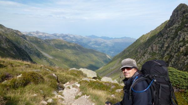
The Author
Journey and Consolidation
What began as a personal vision in 2008 was solidified with the registration of the Treckview brand in 2014. After a period dedicated exclusively to the development of technical architecture and field testing, the first complete route was published in 2018. This journey of nearly two decades allows us today to offer a mature infrastructure, whose depth and technical rigor are the result of constant evolution and a working methodology tested in the most demanding environments.
What is TreckView?
The platform is an immersive navigation system designed to provide an exact visual reference of the mountain environment. It is not just a graphic record, but a tool focused on planning and orientation, where technology is put at the service of the reality of the terrain.
Visual Navigation and Image Processing
The main feature is continuity. A visual line of the trail is maintained at all times (weather permitting) so that no detail of the route is missed. Each scene has been manually leveled and oriented to ensure navigation that is consistent with the real-world perspective. Similarly, faces and license plates have been manually identified and removed, guaranteeing a professional and privacy-respecting digital environment.
Segmented Interface and Quick Access
Information is segmented following the same blocks as the interactive map menu. This allows users to teleport directly to a specific area and access navigation data immediately, optimizing consultation time.
Cartography and Precision Telemetry
Tracks are meticulously curated. Because they are recorded simultaneously with the image capture, the route passes exactly where the camera passes; these are clean tracks, free of signal errors, with integrated Points of Interest (POIs). The interactive map in the viewer features specific iconography (crosses, shelters, springs, anchors) for quick identification, offering additional information via expandable text and direct links to official mountain refuges.
Technical Information and Planning
Outside the viewer, the platform features reversible cards that offer a quick read of the route’s characteristics: water availability, bivouac areas, refuges, caution points, or the presence of safety anchors. Each route is completed with:
Weather and Avalanches: Detailed one-week weather forecast and direct access to the real-time avalanche danger bulletin, linking to the official competent authority for the specific geographic area of each route.
Logistics: Direct link to the trailhead via Google Maps and download of the original GPX track.
Interactive Elevation Profile: A linked system where, as you move the marker over the route map, the point moves simultaneously on the corresponding altitude-distance graph.
Safety and Liability Disclaimer
This platform is a tool designed exclusively for pre-route planning. The information contained herein does not guarantee user safety, nor does it replace the use of map and compass or the technical expertise of professional mountain guides; rather, it serves as a complement for preliminary analysis. Furthermore, the platform does not replace real-time knowledge of trail conditions—such information must be obtained directly from mountain refuge staff, whose instructions must always be followed. Any decisions made in the field are the sole and exclusive responsibility of the user.